Horus View and Explore Mobile Mapping Software for the Road Industry
Horus delivers a software platform to capture, analyse and share multi-sensory data to create a situational awareness solution for road traffic environments.
Image data capture solutions for the road industry
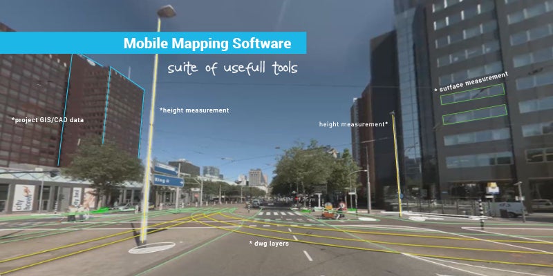
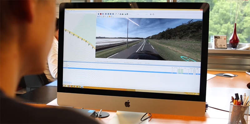
Horus software combines sensor data in order to help people communicate, explore new ideas, save money, and discover trends. The company’s Mobile Mapping system implements its experience in registering public space. Clients are able to record with the Horus Movie recorder, analyse data with the Horus Movie Player, and share recordings with the Horus Webplayer.
The easy-to-install Mobile Mapping system works on a variety of land or mobile systems, either on the road or on the water.
Asset management through pictorial information
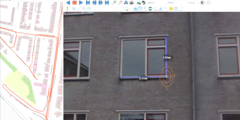
Horus software is ideal for asset management, providing clients with images to interpret information and a complete area overview for inspection.
Road inspection solutions
Horus products are also capable of performing road inspections. Due to the high-resolution of street-level imagery data, every detail is noticeable to ensure every running metre of the road is visible. Horus makes road inspections easier, safer and less time consuming without causing a hinderance to traffic while capturing.
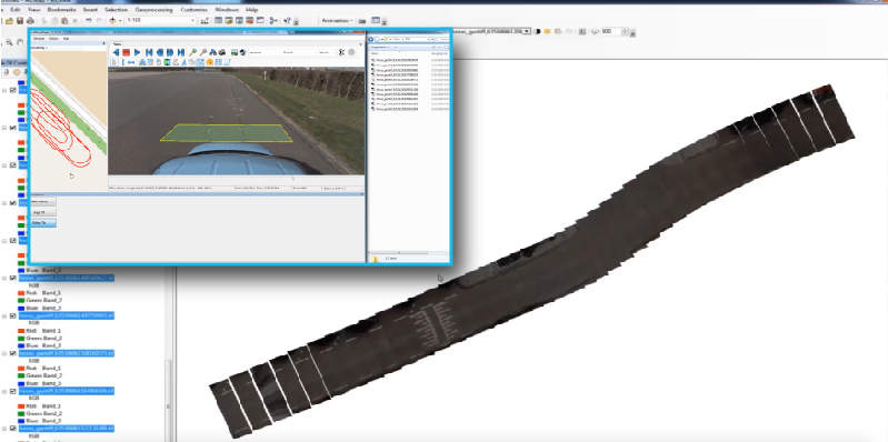
Change detection at street level
The Horus Software Suite helps you to see and communicate changes at street level. Road imagery helps clients to register the situation before and after the project, resolve legal disputes and plan the logistics for major maintenance operations.
Point grey research support
Horus supports Point Grey Research (.PGR) data, which is a video format of Ladybug cameras used in the global mobile mapping sector. This allows clients to add more value to existing hardware with a small software investment.
Horus offers assistance and training to clients who are unfamiliar with video inspection. The company is always looking for the latest developments to ensure its solutions are suitable for client requirements.
Make an enquiry
Verbindingsweg 18
9781 DA Bedum
Netherlands
Horus View and Explore Images

Products and Services

Capturing Services
Horus delivers safe, fast and transparent services to capture roads, waterways and railways. The services are a fast way to update your asset management info and inspections. Rent our products stand-alone or with vehicle and operator.
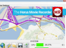
Movie Recorder
It's easy to stay focused and be highly productive with the Horus Movie Recorder.
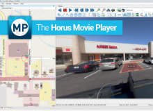
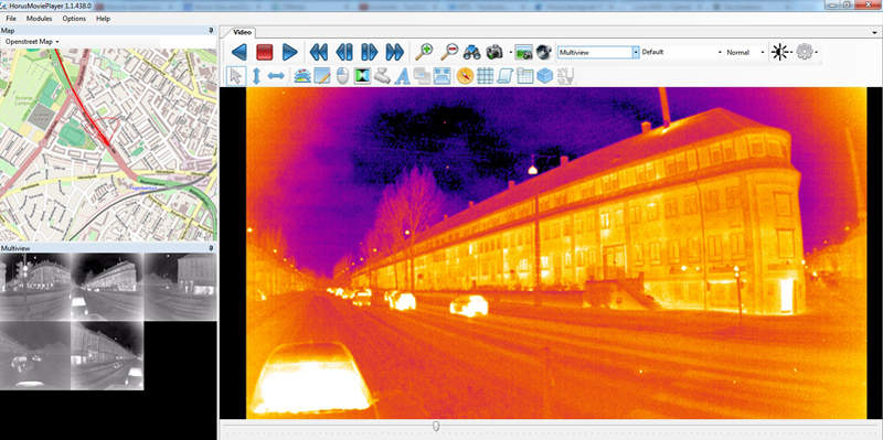
Movie Player
The Movie Recorder comes with our free Movie Player, which will prove to be very valuable as it saves time and money and it's a pleasure to work with.
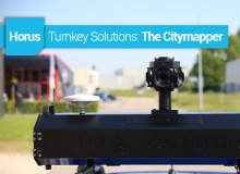
Turnkey Solutions: the Citymapper
Based on several years of experience with videobased mobile mapping, Horus View and Explore developed the Citymapper, a roofbox that includes GPS / INS, capturing hardware and six camera of 5MP.
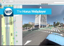
Web Player
Our web viewer makes it easy for a large number of employees to consult the images and data from the inspections and inventories.
Related Projects
Press Release
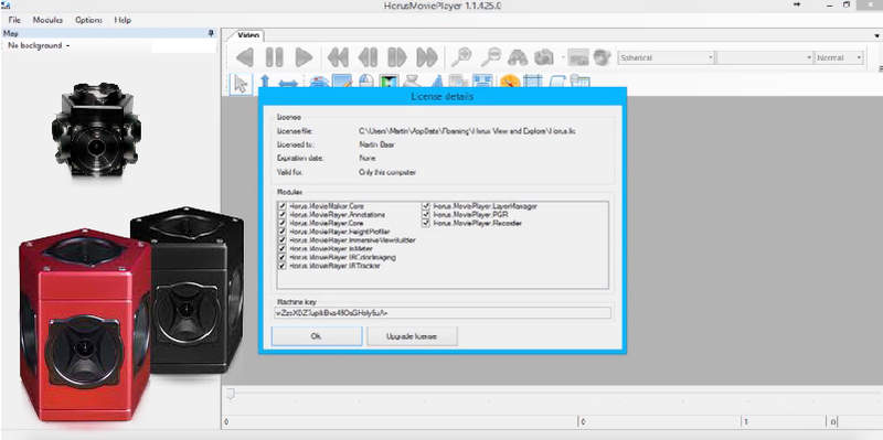
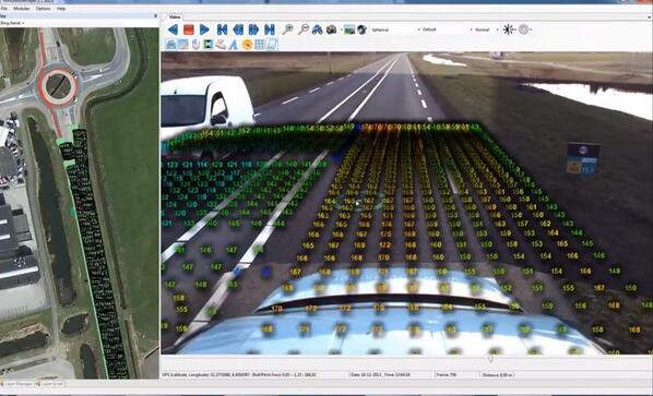
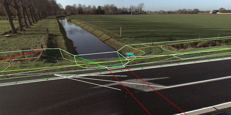
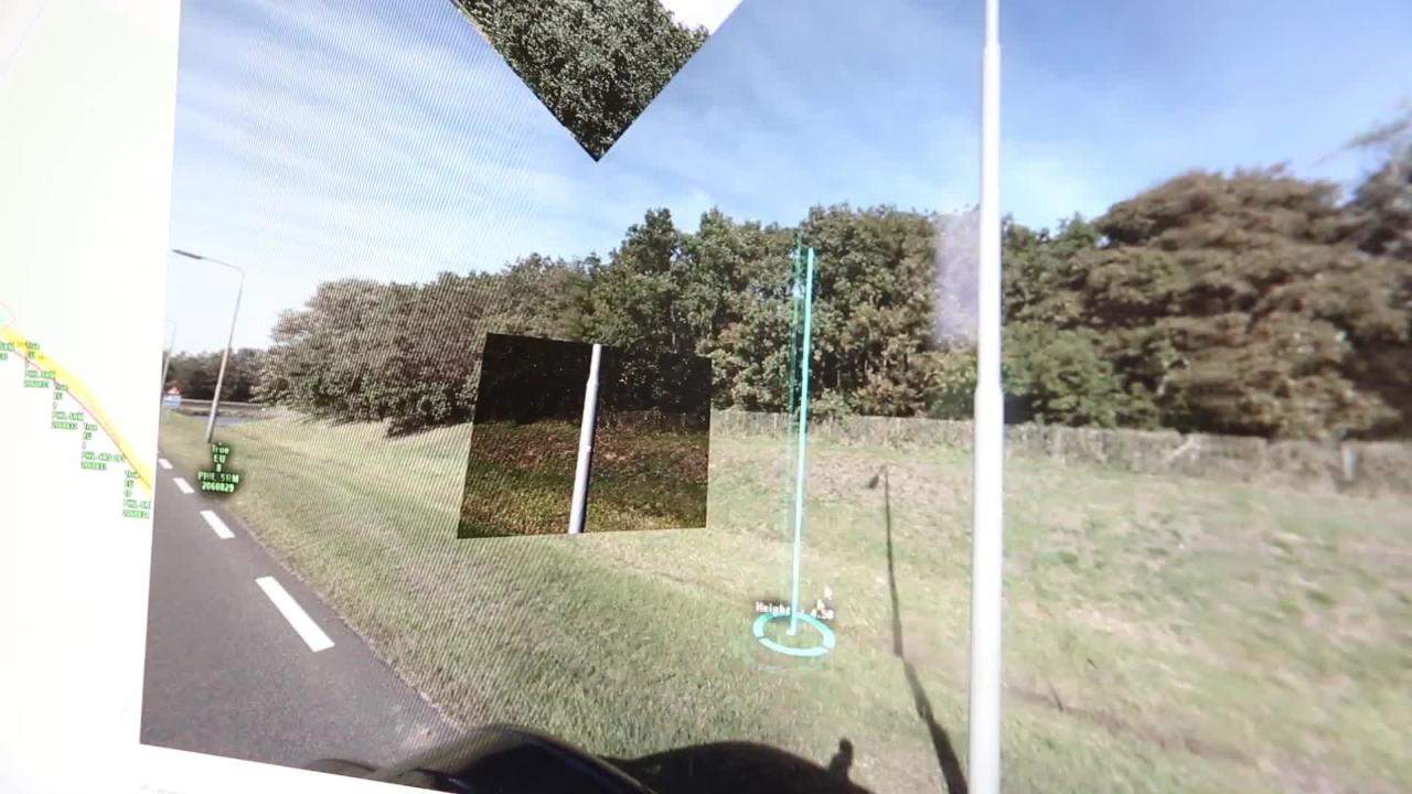
Our newly released tool for the Horus Movie Player is the functionality to automatically detect road lines. This new function is a separate module which can be added to the Horus Movie Player. Specify the area in which you want to detect the road lines, press start and a shape layer will be generated and added to the layer manager.
Read moreWhen your organisation is responsible for the maintenance of roads or assets in the public space, you'll probably have wondered how to improve the productivity of capturing, analysing and sharing data for asset management, road, water and rail inspections, inventories of signs, light poles, road marking and mobile mapping.
Read moreRegional Offices
Verbindingsweg 18
9781 DA Bedum
Netherlands